2016 Hike
Hello All!
I know Maris has announced that I’m back on the trail. Thought I would tell you why, then point out some differences between the hikes.
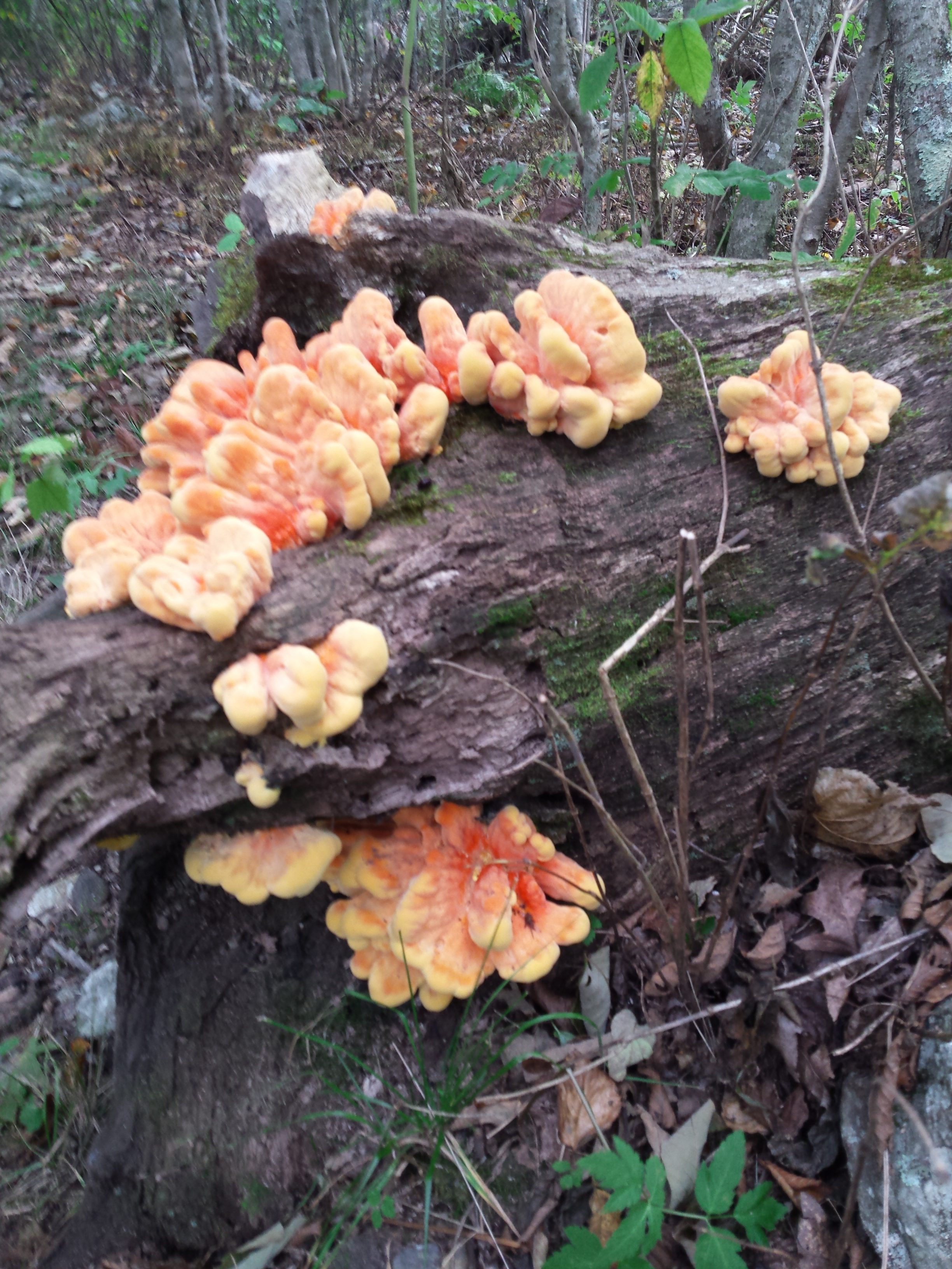
I’ve seen this along the trail, and thought I’d share it.
First off, working for the Bernie Sanders Campaign delayed my start, and some health ailments furthered that delay. I’m feeling better now, and I think this year’s hike is helping me prove that to myself.
Virginia is tough, but not as challenging as last year’s trail. Good thing, too, as six months of campaign food added the 40 pounds that I had lost on the 2015 hike.
I’ve met a surprising number of Southbound through hikers, and they’re cranking out 20 miles a day. I learned from last year’s experience and started out more slowly. I’m now up to 14 miles a day — from the 6 to 8 miles I started with.

One of many views of the Shenandoah Valley.
Hope you enjoy the pictures. Thanks to Viking and Pop Tart for the food, and to you all for following my adventures.
Time

There were people rappelling there too.
Posted in Uncategorized by Tim Liszewski with no comments yet.
Back on The Trail – Take 2 Sept. 11, 2016
Greetings loyal followers and newcomers to Tim’s blog. This is Maris,

Beginning of South Bound AT Harper’s Ferry, VA
Tim’s fiance’, writing the first post as Tim (trail name Time) is approaching Shenandoah National Park in Virginia. He’s been hiking for about a week and a half.
Time reports that it is a very different hike in some respects and in others, it’s just the same. (Rocks, rocks, big ups and downs and more rocks). I drove him up to Harper’s Ferry on Saturday September 10th. We enjoyed a quiet evening of packing, repacking and getting rid of some excess items in an attempt to lighten his 35-pound pack. After checking in at the Appalachian Trail Conservancy headquarters Sunday morning and having his official section hiker photo added to the scrap book,

Ready to Start Southern Leg

Time checks out distances. 9 Miles to the first shelter.
we walked around the town picking up odds and ends. Then I walked him the quarter-mile blue blazed trail to the start of the South Bound AT (SoBo as the hikers call it). It was a tearful parting for me (and Monk) but I was excited that Time and Monk were back on the trail and at least had a much better idea of what to expect.

Maris Sees Tim Off

Time Heads South
Time would want you to know that the biggest change with this hike is that he is living up to his name and heeding the reminders of other hikers to really experience the trail and take his time. He averages about 7 miles a day as he slowly gets back into shape. He feels pretty good except for his knee acting up and needing to toughen up his feet again.
So here are the Trail facts: He has gone about 53 miles so far, lost 6 pounds, heard barred owls, been huffed at by deer and heard coyotes howling. He has met some interesting people including a man (trail name Viking) who went off on a mile and a half side trail in search of beverages at the park, lost the trail and 4 hours later returned with Gatorade and stories of startling a bear, a buck and some wild turkeys!
Tim said there have been many designated springs to get water but they have been dry. 🙁 Monk was excited to help filter water at the first stream.

Monk gets ready to fetch water
Time is grateful to Pop Tart for sharing Mountain Home meals and the college students who gave him water when he was just about out. He is ever reminded that “The Trail provides” and trail angels exist! He enjoyed a night spent at the Blackburn AT Center and another night at the castle-like building that is the Bears Den Hostel.

Built as a summer home for a rich family in the 1920’s or early 1930’s.

The resident bear at Bear’s Den Hostel in northern VA
He has done some stealth camping (shhh, don’t tell) and made it through the 13 mile set of steep ups and downs called the Roller Coaster. This hike is a section hike with the goal of finishing as much of Virginia as he can.
That’s plenty for now — check back in a few days to see and read more about Tim on the trail.
Posted in Uncategorized by Tim Liszewski with 1 comment.
Northern Leg Complete

From the Abol Bridge. This is the view after emerging from the 100-mile Wilderness.
It took four months and 25 days, but my trek from Harpers Ferry, West Virginia to Mount Katahdin, Maine is done.

Tim ready to hike Katahdin.

Perfect Hiking Day

The summit was windy, with clouds trying to photo bomb us.

Profile of the AT’s Hunt Trail on Mt. Katahdin.

Monk and Bear stow away in the backpack to climb Katahdin.
I have aching knees, numerous scrapes, and plenty of sore muscles. I also have a multitude of memories that will remain after the pain fades.
Time will provide some perspective on this trip, which means I’ll have at least one more post about the northbound hike.
For now, know that I couldn’t have persevered without the support — practical and emotional — that all of you supplied.

Boulder field. There were 2 miles of boulders to overcome on this climb.

This is when you know you have work to do to gain your reward.
Maris and I are driving back to South Carolina, which will give me some reflection time. Meanwhile, we’ve included many shots of our adventures in Maine for you to enjoy.
TJL
Posted in Uncategorized by Tim Liszewski with 2 comments.
Reflections From Maris
Greetings All ,
I flew into Bangor, ME on Saturday (9/26) and rented a car. The plan was to rendezvous with Tim at the Abol Bridge and Campground trail head, a location that was deep in Baxter State park. I had no idea where I was going or how to get there except that it was outside a town called Millinocket. I had made reservations at the Appalachian Trail Lodge

Please don’t feed the bears, but a drink’s okay!
unsure if Tim would be finished with the 100 miles wilderness, but was confident that we would meet up somehow.
On my hour and a half drive to Millinocket, I received a call from Tim stating that he was out of the woods, had lucked out on a ride and would meet me at the Lodge in Millinocket. Yeah, what a relief! He was safe and I wouldn’t have to find my way to some remote spot in the dark.

Monk tells Berry Bear and the others what they’ve missed.
We reunited and had a delicious dinner at the Appalachian Trail Cafe. The Cafe has a tradition of Through-Hikers signing the ceiling tiles at the completion of their hike. It was very fun to see Kyle’s (Shortbus) name there as well as other hikers Tim met along the way.

Class of 2015 Through- Hiker Tile at the AT cafe.
Tim decided not to summit Saturday as planned since the hike through the Wilderness had taken a little longer than expected. He wanted to clean up, eat up and rest up before his final mountain climb of the trip. Sunday was a beautifully clear, sunny, warm day. Tim and I decided to take a short (for him) 4-mile hike so I could see some of the Maine woods.

Time and Carebear ready to take a hike.
We took a picnic lunch with us on our hike and in the middle of a wooded glen we had a picnic and…he proposed! I gave him a book of Thich Nhat Hanh’s called ‘True Love’ and asked him to marry me! We both said yes!

Tim and the kids enjoy a picnic lunch with a surprise for Tim.

And then he had a surprise for me. We’re engaged!
A little back story to the engagement ring: A week ago Tim sent a package home with instructions to me not to open until his return. He asked me to bring it along to Maine. The package was an engagement ring he had bought in Rangely, Maine and had sent home so it would not get lost. The ring is sterling silver with two bands running parallel which then overlap.
The hike and the ring are a great way to visualize his trek and how our paths have also run parallel and overlapped. The Blueberry Ledges Trail that we hiked on Sunday had a little taste of what he had experienced hiking the AT — we rock hopped steep granite boulders, scrambled across streams and walked some smooth, even paths through fields of blueberry bushes. Unfortunately, all the bushes were stripped of their berries by hikers and other wildlife.

We hike Blueberry Ledges trail in Baxter state park. 4.4 miles.
Sunday night we stayed at a wonderful Inn called Parks Edge Inn in Millinocket. Our room was a 3-bedroom suite with full kitchen, bath and living room. It even had free wi-fi and cable. We were pretty tired out from our hike and had a yummy dinner of a double order of ribs (for Tim) and spinach lasagna for me at the AT Cafe.
We went to bed early so we could get up at 6 AM in preparation for Tim to start his 10.4-mile hike to summit and descend Mt. Katahdin.
Posted in Uncategorized by Tim Liszewski with 1 comment.
Time Marches On
Maris reporting [Sept. 19th]:
With trepidation on my part and excitement of only having 114 miles left to go, Tim has entered the 100 Mile Wilderness. He had an excellent breakfast of all-you-could-eat pancakes, eggs over easy and bacon. Monk even got his own stack!

They made him a cairn of pancakes!
Tim covered about 37 miles in 3 days walking from Caratunk to Monson, ME. He climbed up, over and through more rock scrambles like this one on Moxie Bald Mountain,

Near Moxie Bald Mountain, ME
and had to ford several rivers and streams. One river, The Piscataquis, has a very fast current and is so wide that there is a rope strung to help hikers across.

The Piscataquis River felt cool on my feet.

Rosencrantz crosses East Branch of Piscataquis River.
He says the weather has been beautiful; a little hot for his taste (in the 80’s during the day) but getting cool at night. We are praying for a cool clear day next Saturday when he will hopefully summit the holy grail of Mt. Kathadin.
I will meet him at the end of the trail and enjoy some fall foliage as we drive back to SC.
Cell phone service is spotty or non-existent in the Wilderness so you will get updates as I do. Check back in, leave comments, send positive thoughts.
Thank you all for your love and support.
Posted in Uncategorized by Tim Liszewski with 1 comment.
Time
Time works differently on the AT. It’s measured in miles hiked per hour by some, days until Katahdin by others, and days until you can resupply by those of us obsessed by food.

Monk has his eye on the banana.
I’m in that last category at the moment, though I pay attention to the others. Looking forward to something that’s not camp food really motivates me. I can hike 2 miles an hour on days I expect to reach a town with a good restaurant.
Time can drag on hot days, or days with steep climbs or descents. Some days I stop at a campsite or shelter early because getting to the next would require a night hike. Then time drags, until another hiker arrives to help pass the time.

Five, Time, E-Z, Birdie, Squeeze, Tunes Loose leaf, Devon & Forever gather ’round the campfire.

The canoe is considered part of the Trail. (It even had a white blaze on it.)
For the record, I usually average 1.5 miles per hour, expect to reach Katahdin by September 26, and look forward to being with my love on that day as well.
You know I’m referring to Maris, not an all-you-can-eat buffet, right?
Guess it’s good my Trail name is Time.
Posted in Uncategorized by Tim Liszewski with 2 comments.
Grinding Through
[As of Sept. 5th:]
For those of you who appreciate metrics, I’ve hiked 927 miles, 17 peaks 4,000 feet or higher, and 4 months on the AT.
I have approximately 225 more miles in Maine,

View of valley in southern Maine
including the Hundred Mile Wilderness (a stretch where resupply is a problem).
Three ibuprofen each night allow my knees to work in the morning. (Maris sent a knee brace that should help.) And I have at least three more summits of more than 4,000 feet before Mount Katahdin, the northern end of the AT.
Finally, it should take another three weeks to reach Katahdin.
Can you all hang with me a bit longer?

Feel the Bern
Posted in Uncategorized by Tim Liszewski with 3 comments.
The AT Isn’t A Walk in the Park
There’s been much interest in the AT recently. The Associated Press, the New York Times, and a new movie called “A Walk in the Woods” have all chronicled its allure. What none of these media mention, however, is how dangerous it can be if a hiker is unprepared or unlucky.

Watch Your Step.

Serious Rock Climbing

Approaching a tiny notch, about to get squeezed .
Rock climbs on 4,000-foot mountains, bouldering on near vertical ascents and descents, and assorted wild animals are all to be found following the white blazes. (White markings showing hikers the trail route are called “blazes.”) Even easier stretches of the trail can be hazardous.
Here’s one recent experience I had in New Hampshire:
I had finished climbing a series of ledges and stopped at the top for a quick drink of water. Another hiker was there, so we chatted a minute, then went in different directions to continue our respective hikes. In 30 seconds, I heard a loud “Ow!”, followed by a cry for help.

These roots will trip you up.

Boulders are not fun.
The other hiker had fallen, so I went over to see if I could help. The hiker was sitting on a slab of flat rock, testing to see that all her limbs worked. When she stood up, she was unable to put weight on one foot. She worried that she had sprained or broken her ankle. After resting a bit, she tried again. It was obvious she wouldn’t get down the mountain unassisted.
She decided to call for emergency help. Before she did that, we set up her tent, and made sure she put on warm clothes (in case she had to spend the night on the mountain). She made the call. When she reported her location, I asked her the important questions: did she have enough food and water; did she need to call someone who was meeting her; did she need a pain killer?
Another hiker got her more water, while I made sure she elevated her foot, stressing she shouldn’t remove her boot for fear the foot might swell. After a couple of hours, she insisted we should both find shelter ourselves. We did so, reluctantly, because we knew she was right. We gave her our phone numbers and email addresses, then went on to find shelter. A couple of days later, she reported that she had broken her fibula, the thinner bone in your lower leg.

After the notch, the trail leads up to the arm.
I have known others who hurt themselves. One tore tendons in his knee. Two more suffered stress fractures in their feet. One woman had bent her finger sideways, then just popped it back into place.
Hiking the AT is more than walking along a wide trail at a leisurely pace. It’s finding water when you’re running low. It’s finding shelter when bad weather hits. It’s planning how many meals you’ll need until you can make it to the next town.
The AT is not for novices — I’ve been very lucky people taught me how to survive on the Trail. Thanks to all of you AT teachers for the help.
Posted in Uncategorized by Tim Liszewski with no comments yet.
Northern Trails
[8/31]
When I finished the White Mountains — and then New Hampshire — I thought the hard part of my hike was complete. Once again, the Trail proved me wrong.

Entering Maine — The Fun Begins…
Maine tested me within the first mile, with an almost vertical 40-foot drop to negotiate. That was the only way to the first shelter in the state.

Goose Eye Range
The first mountain range in Maine is the Goose Eye range. It was hard hiking, but the hardest part was getting stuck above my knee in mud atop one of them. I couldn’t get myself out, but three hikers arrived to help.

Stuck in the mud,
One had a trowel to help me dig my leg out, and another extended a hiking pole and pulled me out of the muck. Their plan was much better than mine, which was to lasso a passing moose — if one were to pass.
Then came Mahoosuc Notch

Relentless Bouldering
— more than a mile of bouldering, with no escape. An average AT hiker can do a mile in 20 to 30 minutes. With the Notch, an average time is 2 hours.

Speck Pond — The highest elevation of any body of water on the AT…3,438 feet above sea level!
I’ll just say I’m glad to be out of it.
Hope the rest of Maine gets easier.
Time
Posted in Uncategorized by Tim Liszewski with no comments yet.
MAINE-ly Rocks
Maris reporting (8/28):
Tim has been on the trail since May 3, 2015, almost 4 months. We’ve seen each other twice. He has hiked, climbed rocks, slogged through mud and still has a ways to go. He has entered Maine and is expecting to complete the dreaded Mahoosuc Notch and arm in the next few days and then has about a 15 mile hike to the town of Andover where a care package/birthday surprise awaits.
Tim reported several scary adventures which he will share later. He has had very sketchy cell service this week so communication has been difficult, but not as challenging as the boulder-sized rocks he’s had to scramble up, over and around.
He has covered more than 850 miles and has about 280 more miles to go to reach Mt. Katahadin. His knees continue to hurt and that’s not good.
We are with you Tim…No matter where the trail brings you. Hike on, be safe, and hope you had a wonderful birthday under the stars.
Posted in Uncategorized by Tim Liszewski with 1 comment.